JMapView
... a mapping application for FlightGear, the open-source flight simulator.
This program is a mapping utility (similar to Atlas), to be used by users
of the free flight simulator FlightGear.
Features
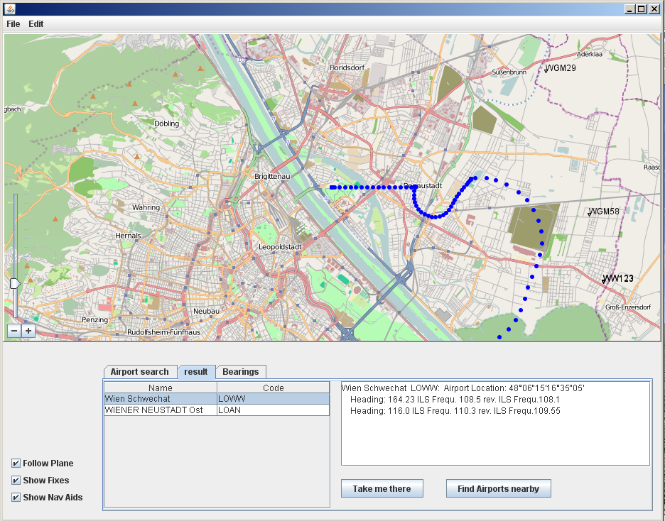
- The Program parses the NavAid and Fixes files of an existing
Flightgear installation and displays them as an overlay on a map from
the OpenStreetMap Project.
- The program listens on port 5500 for nmea packets from FighGear
and displays the current plane location on the map. Additionally, the
bearing to NavAids and Airports within the current view of the map is
displayed.
- The user can search for a specific airport, display information
(like runways, ILS frequencies) about this airport.
Download
Go to the
Download Section of the project and select the package jmapview
and download the file jMapView.zip. The source can be obtained from
the package jmapview-src. Alternatively, you can
browse
the sources via Subversion.
Installation
Download the Zip Folder jMapView.zip and unpack it in an empty directory.
Double click on jMapView.jar - the program should start. Otherwise open a
command console and type:
java -jar "jMapView.jar"
Click Edit/Preferences and set the data directory of your Flightgear
installation (E.g. on my Windows installation this is under
C:\programs\games\FlightGear\data , but on Linux this is usually a
separate directory).
Credits
The map viewer is from the project javax-ws from swinglabs, parts of the
Flightgear data file parsers are from the Kelpie flight planner and the
nmea parser is from Atlas. Thanks to these projects (their programmers)
for their contributions.
Screenshot